New Hythe:
Abbey Meads
Denis Anstey
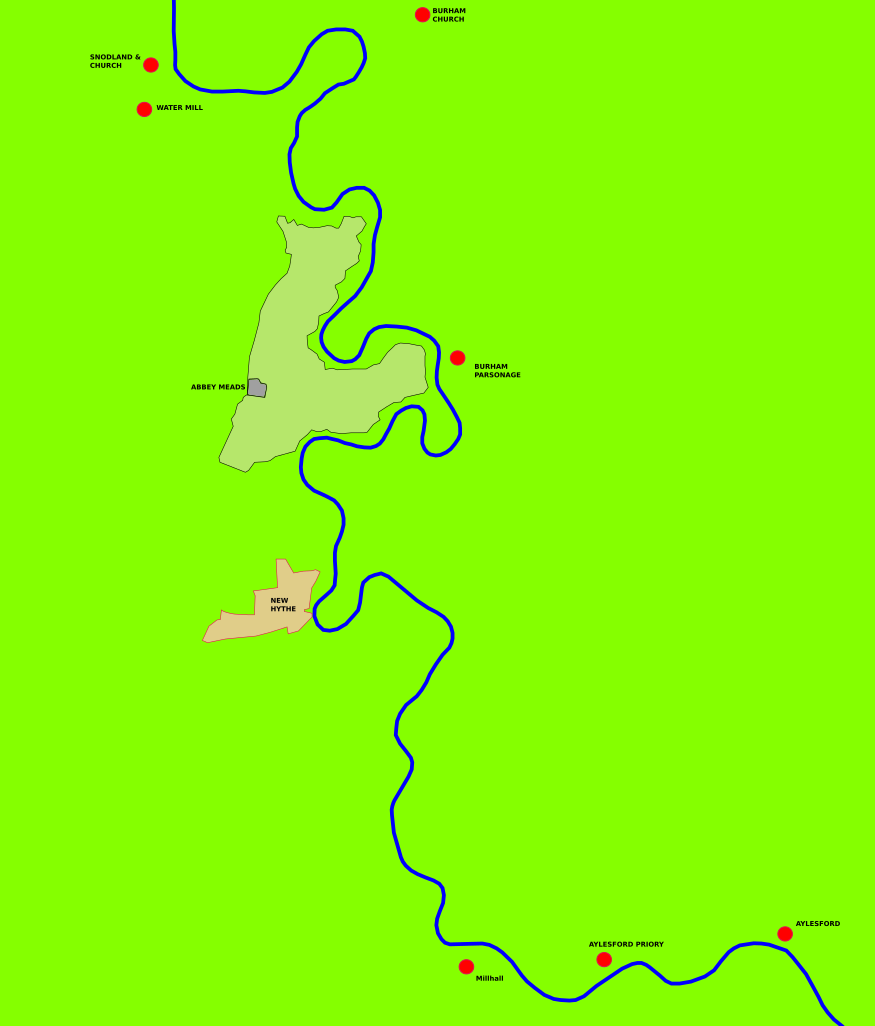
The graphic above is based on an image from the British Library of the 1797 1st edition ordnance survey map. ©The British Library, c07805-06 MAPS OSD 120.
It illustrates the
meanders and oxbow of the Medway between Aylesford and
Snodland at a time before canals were dug in order to
straighten the river to improve navigation.
The focus of
attention is Abbey Meads. This consisted of a
farmstead enclosure and a larger enclosure for the
land. The whole site was within the marshland of
the river and partially set in the meander at Burham
Parsonage.
Nearby was the
village of New Hythe (New Harbour). In fact not so
new for an early reference c1220 identifies the
village. The feoffment records the Abbess of
Malling to Rochester Priory one acre of meadow at
Newhythe there near the river Medway.
At the dissolution
of Malling Abbey in 1548 the site passed into private
ownership and survived as a farm until the 1970s when it
was lost to mineral extraction. In the l9th
century the meander via Burham Parsonage was lost when a
canal was dug in order to straighten that part of the
river.
Research continues
to try and establish the age of the site and when it
became part of Malling Abbey.
Was this site, an
enclosure set in marshland, an early religious house
predating the monastery?